- 200505-06 - Iowa City
- 200903-04 - Iowa City
- 200902 - Iowa City
- 200901 - Visiting India through January 15, then back in Iowa City
- 200812 - Winter comes to Iowa City, Dec. 25 - Jan 15 traveling to India
- 200811 - Iowa City
- 200810 - India from October 3 to 14, then back in Iowa City for the remainder of the month.
- 200809 - The Fall Semester at the University of Iowa Begins
- 200808 - The final weeks of summer vacation
- 200807 - Includes updates from the Border to Border Tour
- 200806 - Summer vacation begins
- 20080120-20080613 - These photos are available by accessing the archive on the right side column of this page.
2008-06-14
GregoryCam News Update
2008-06-13
Additional Photos for 20080613fr
Willow Creek Trail
Melrose Avenue by way of West High School.
Visiting Mormon Handcart Park
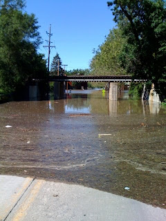
Mormon Trek is closed north of Melrose Avenue
Mormon Trek is closed to automobile traffic because the road is flooded before it connects with 2nd Street / Highway 1 in Coralville.
Coralville Iowa now under about 5' of water
North Riverside Drive
be at about 5' covering the street.
Iowa Avenue Bridge Bike Path, flooded
This photo is at the north west corner of the Iowa Avenue bridge. The bicycle path that goes under the bridge had been flooded. The bridge was closed to automobile traffic, but bicycles and pedestrians were crossing it just fine.
Crossing the Burlington Street Bridge
There were reports that the Burlington Street Bridge would be closed at noon. Then a report that it would be closed at 3PM. Cars were still crossing after 5PM (see later photos of bridge).
Traffic on Prentis St. at Gilbert
By mid-day it was very difficult to get around Iowa City by car. Traffic was at a standstill on the available roads. The above photo shows cars that look like they are parked, but they are all in line stretched to the horizon waiting for the light to change. This view is looking west down Prentis Street from Gilbert Street.
Looking east on Highway 6 from Iowa River
Just east of the Highway 6 bridge, on the east side of the Iowa River, the above view is looking to the east where the river started flowing over Highway 6. Hills Bank is the brown building in distance on the right. It was possible to continue east on Highway 6, but only through about 7 inches of water (or walking along the meridian in the middle).
South Gilbert Street, two blocks south of Highway 6
The above photo is a view looking west from South Gilbert Street (about two blocks south of Highway 6).
Gilbert Street / Waterfront Drive - South of Highway 6
Gilbert Street turns into Waterfront Drive just south of Highway 6. Hills Bank is to the right (not shown). This view is looking south toward the Aldi grocery store seen to the left.
Water Crossing Highway 6, east of Iowa River
The above photo is a view looking west toward the Highway 6 bridge from the east side of the Iowa River near Hills Bank.


